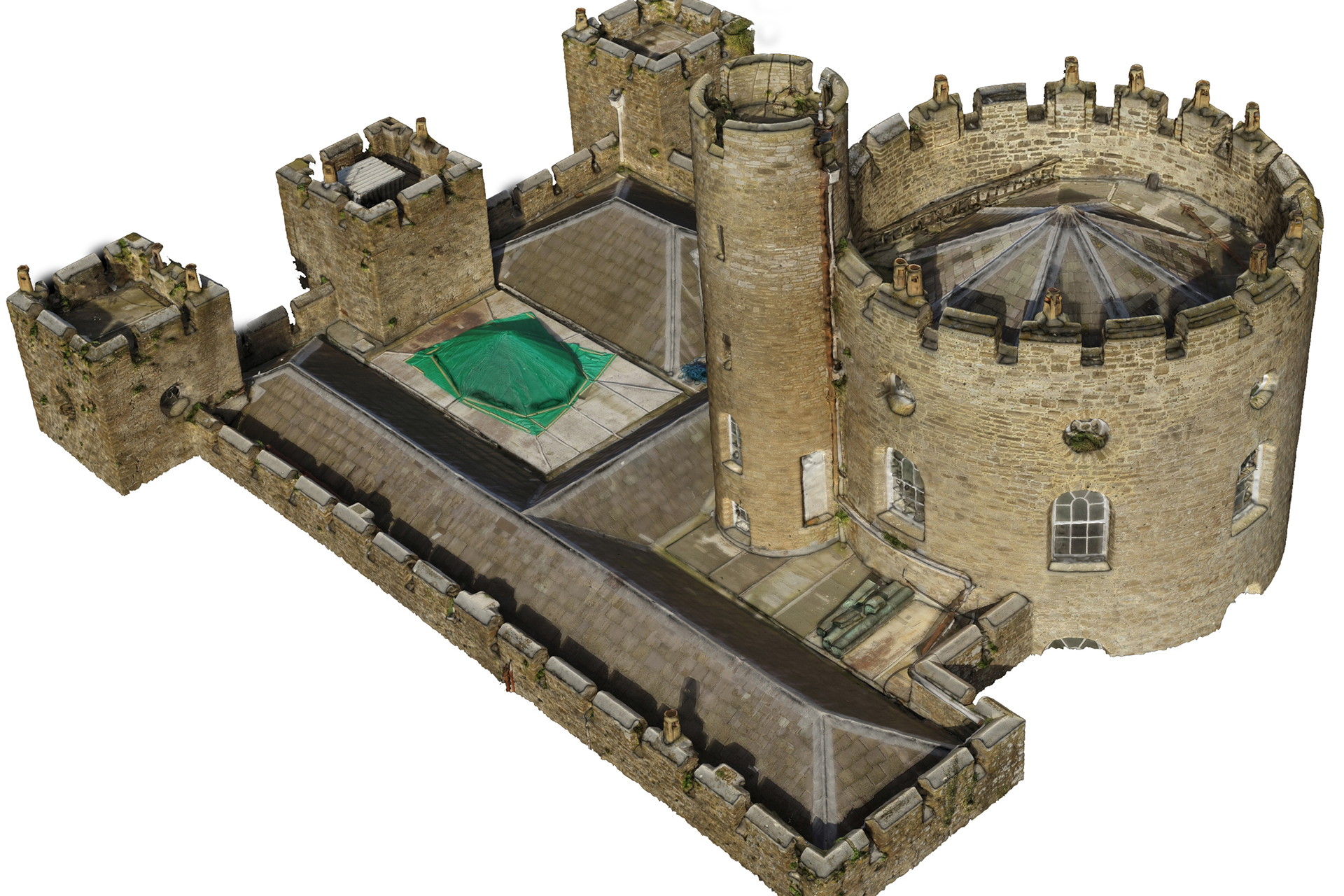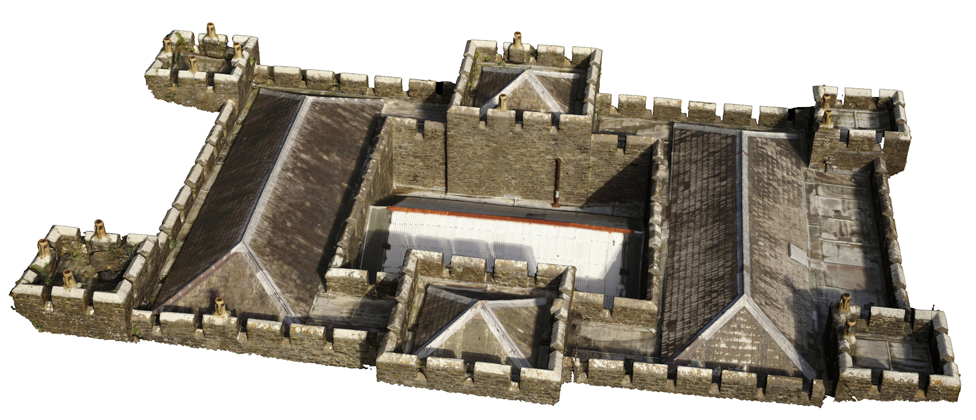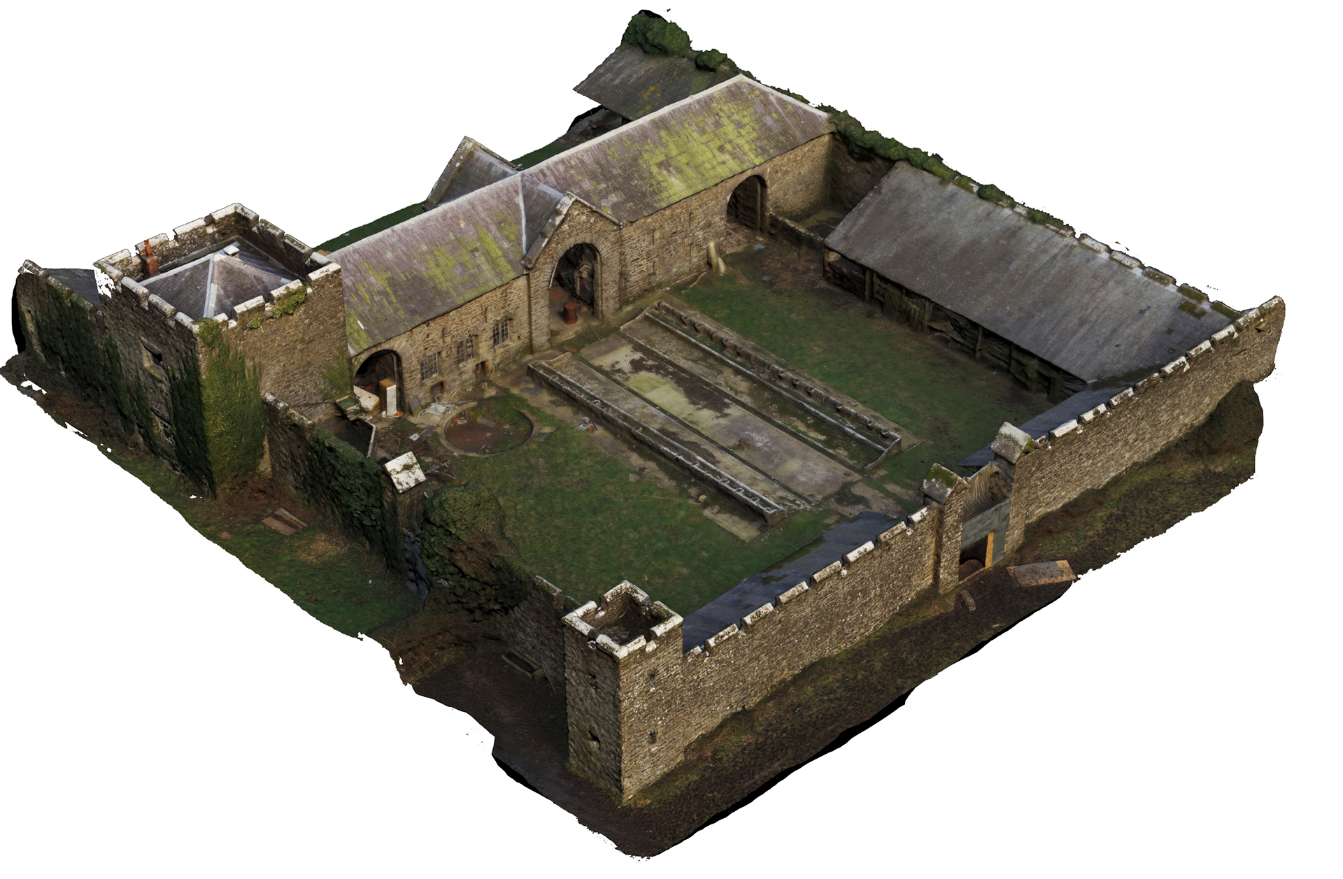


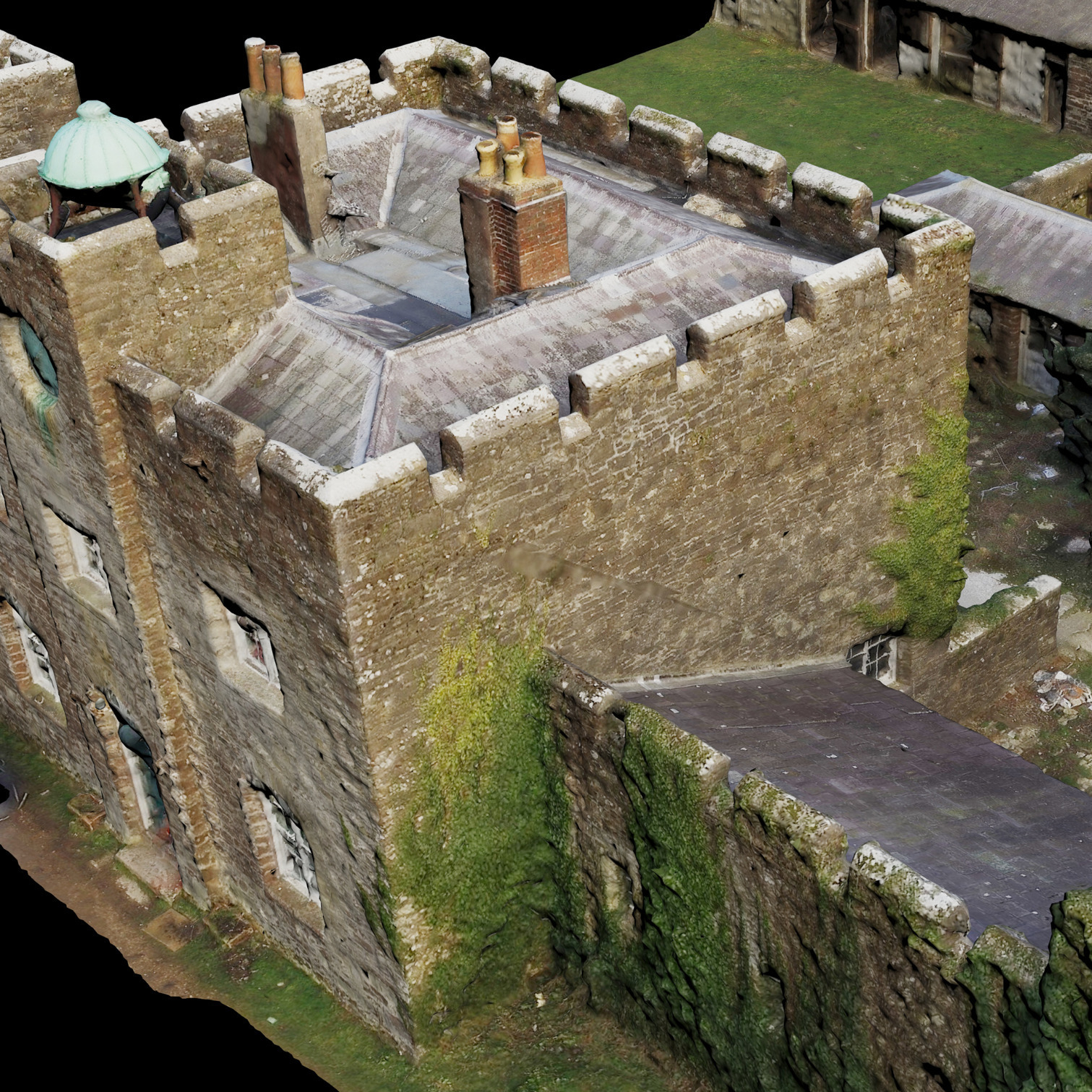
Drone based imagery has become a part of the surveyor’s toolbox, to allow the capture of geometric and textural data from both an aerial and terrestrial perspective. Currently we have used the technology to capture inaccessible areas to other methods to supplement laser scanning, or, large areas needing rapid capture.
The technology gives an aerial “bird’s eye” view of their site or building, allowing informed decisions to be made about the management of complex sites or inaccessible areas.
APPLICATIONS AND BENEFITS INCLUDE
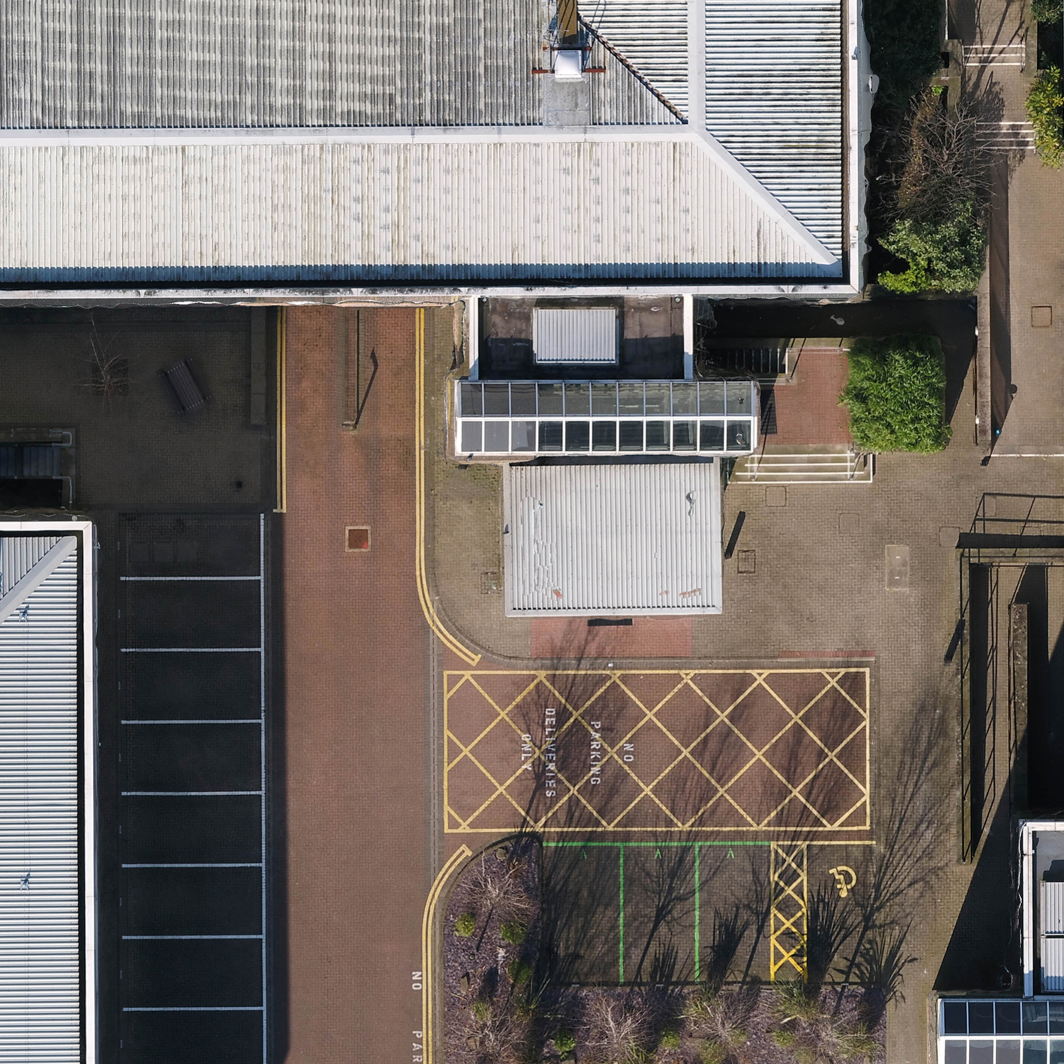
A photographic record of sites in a scaled ortho-photo format
The creation of 2D, 3D and CAD files and Pointclouds
Accurate visual record of the condition of the building or site
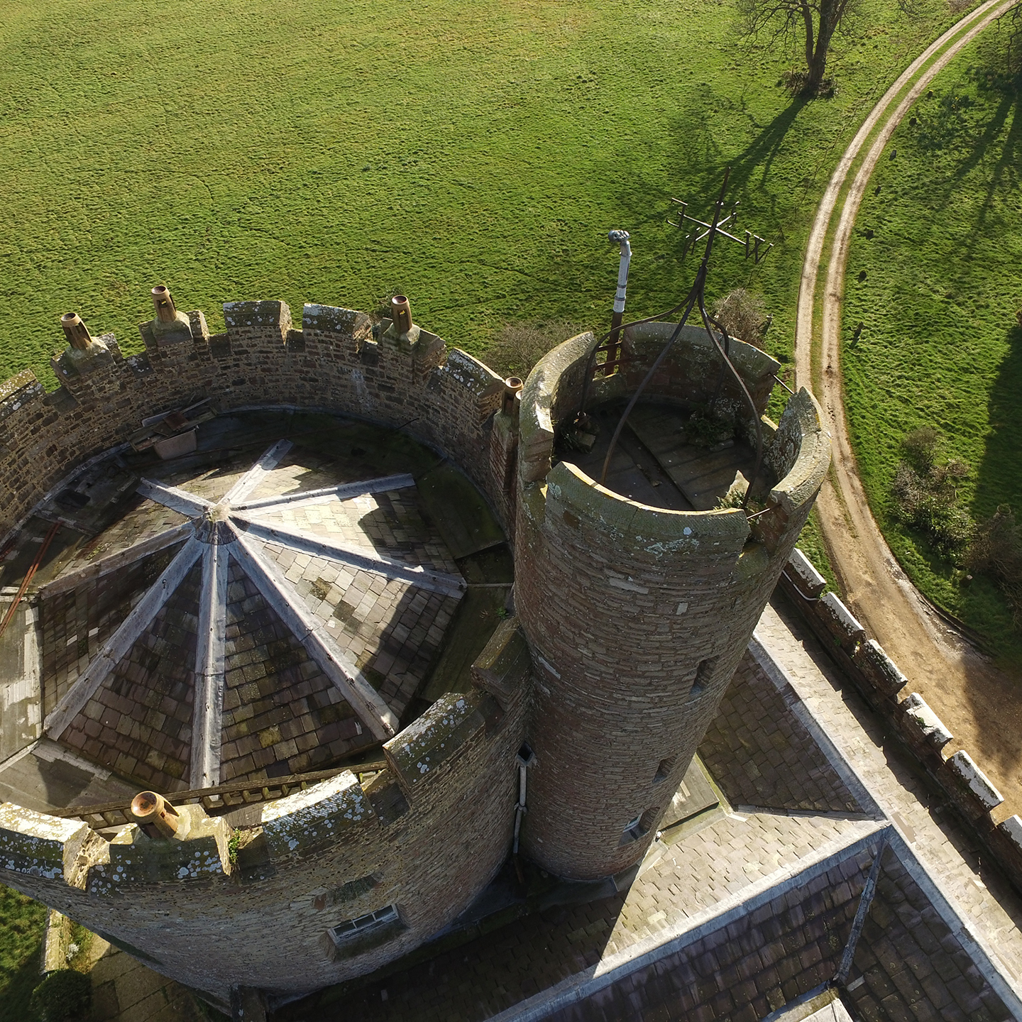
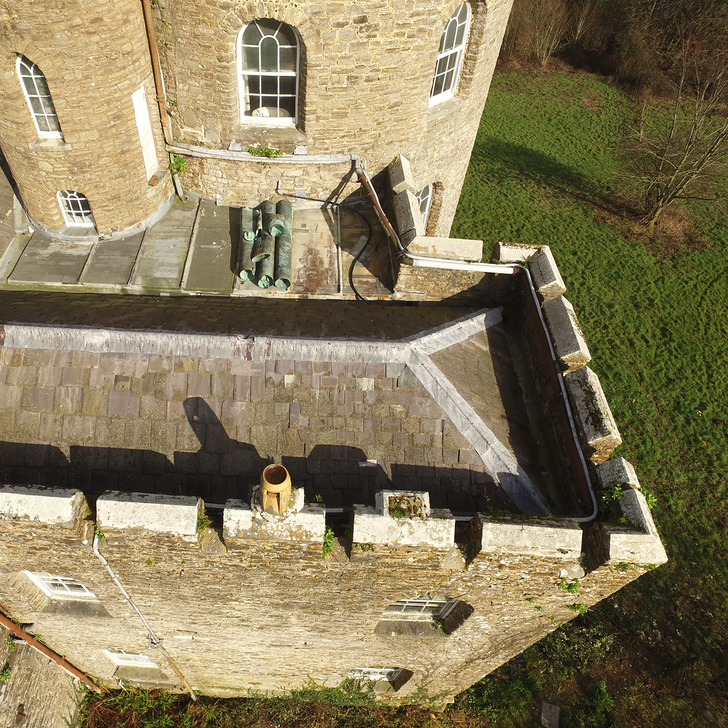
Inaccessible roof surveys giving both a measured record and condition survey
Surveys of large areas with limited clear access, e.g. warehousing, factory and car parks
Surveys of inaccessible buildings due to poor condition or structural instability